Visibility during instruction
- See surrounding traffic during a training flight
- Monitor solo students in real time
- Provide actionable guidance when a student needs it
A portable transponder for general aviation aircraft, delivering continuous collision avoidance, flight data recording, and real-time fleet tracking.
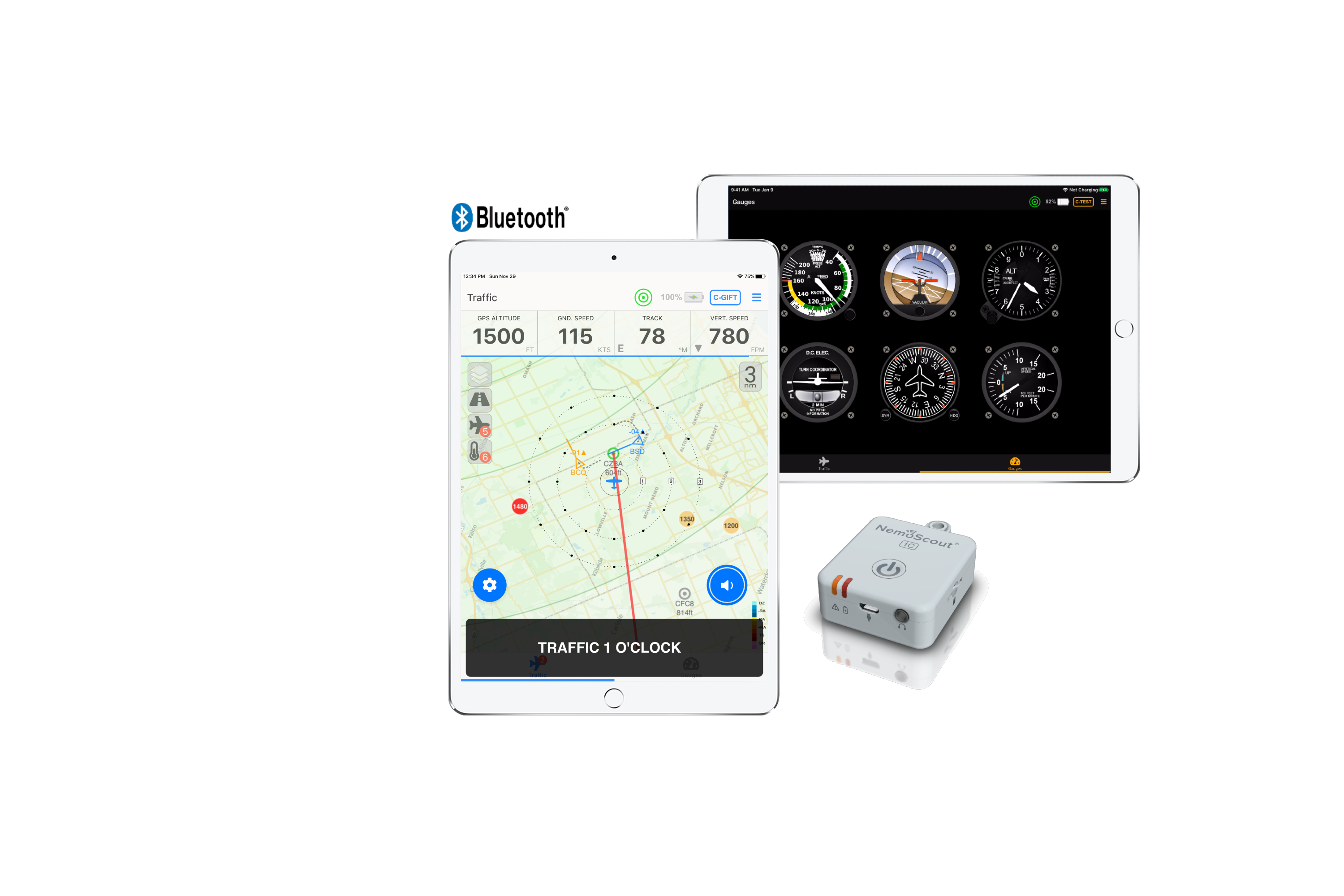
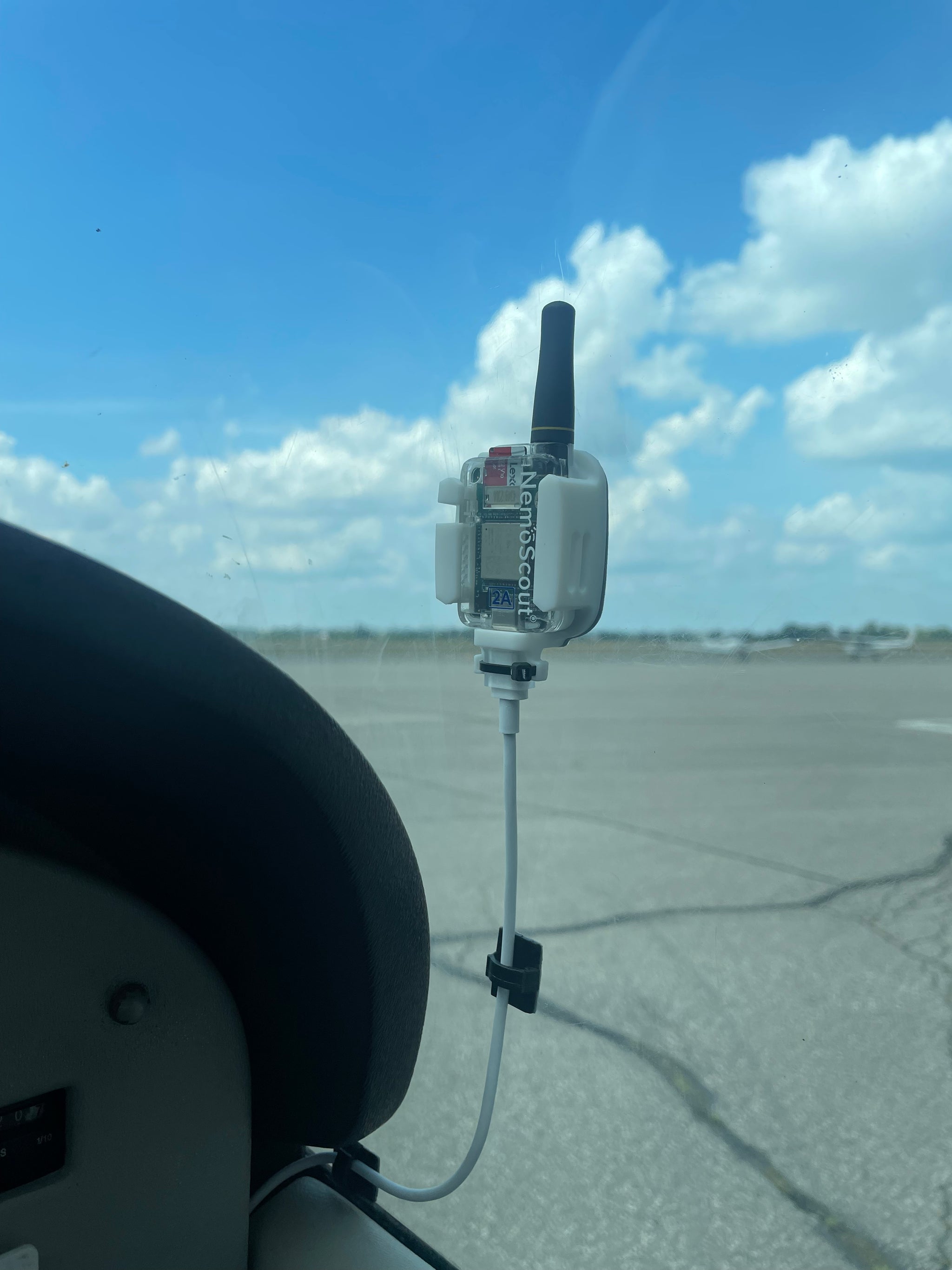
NemoScout is a long-range, low-power portable transponder. It tracks the position and trajectory of nearby NemoScout-equipped aircraft, alerts the pilot to potential conflicts and most man-made obstacles, and records every flight in a format compatible with major flight data analysis tools.
The unit operates aircraft-to-aircraft without external infrastructure. Where transmitting base-stations are available, NemoScout-equipped aircraft are also rebroadcast as ADS-B targets and receive data-link weather services within range.
NemoScout integrates collision avoidance, obstacle warning, flight data recording, and fleet tracking into a single 24-gram unit that mounts in under fifteen minutes.
Continuously tracks NemoScout-equipped aircraft in range and alerts the pilot when trajectories converge or minimum separation is exceeded. Forward visibility typically 10 nm; rearward typically 6 nm.
Built-in obstacle and aerodrome databases generate visual and audible alerts when terrain, towers, or structures fall within the projected flight path.
Records position, altitude, attitude, and event data at 1 Hz in Garmin G1000 format on a MicroSD card. Supports automated upload to CloudAhoy and FlySto when within base-station range.
Transmits aircraft position to other equipped aircraft and to ground base-stations using the nemoMESH protocol, providing dispatch with a real-time fleet picture in any web browser.
NemoScout works with the leading Electronic Flight Bag and flight data analysis platforms:
NemoScout addresses the operational realities of flight training units: instructor oversight, dispatch visibility, safety auditing, fleet management, and renter accountability.
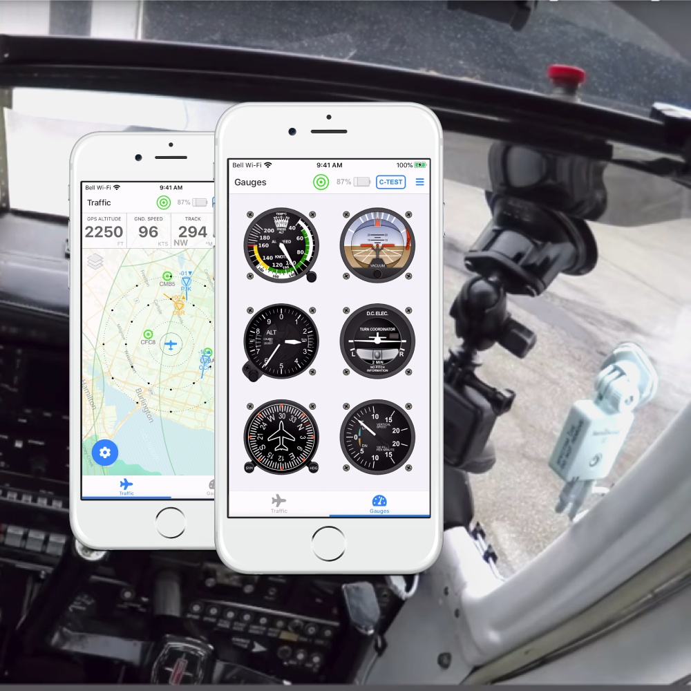
The NemoScout web application connects to the transponder over Wi-Fi and displays surrounding traffic, obstacles, airspace boundaries, and a full set of attitude, heading, and altitude gauges.
For pilots already operating an Electronic Flight Bag, NemoScout integrates directly with ForeFlight, Garmin Pilot, FltPlan Go, WingX, and SkyDemon — supplying traffic, obstacle, and synthetic-vision data in the EFB the pilot already uses.
NemoScout-equipped aircraft within the CIFIB base-station network are rebroadcast as ADS-B targets and receive data-link weather and traffic services up to 150 nautical miles from the airport. There are no monthly data fees.
NemoScout is FCC and Industry Canada certified. Full technical specifications are reproduced below; a printable datasheet is available on request.
NemoScout is sold individually through the online shop. Fleet deployments — flight schools, FBOs, and rental operations — receive volume pricing, installation support, and a base-station deployment plan.